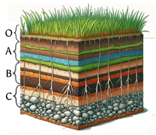
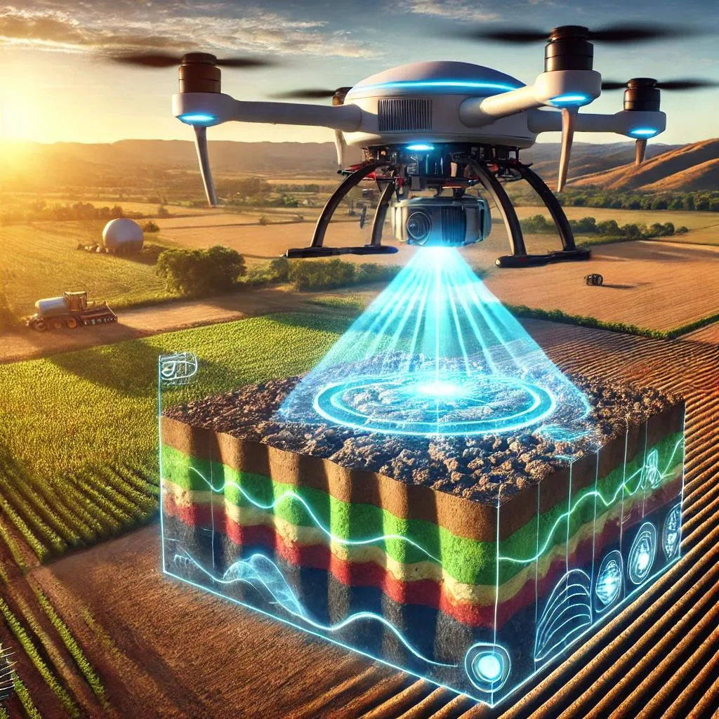
We develop drone-borne Ground Penetrating Radar (GPR) with AI to create 3D soil moisture maps — enabling precise, water-efficient megafarm irrigation.
From a single drone flight over a megafarm to a precision-ready irrigation map — the full pipeline runs on our custom GPR hardware and AI models.
Drone flight
GPR antenna mounted on drone flies a grid pattern over the farm field.
GPR signal capture
Radar pulses penetrate 3+ ft underground and reflections are recorded in real time.
AI / ML processing
Trained neural networks classify raw signals into moisture levels and soil layers.
3D moisture map
Output is a volumetric 3D subsurface model showing root-zone moisture distribution.
Precision irrigation
Irrigation designers use the map to allocate water only where and how deep it's needed.
Radar systems redesigned for drone integration, enabling 3D root-zone soil moisture maps across megafarm fields.
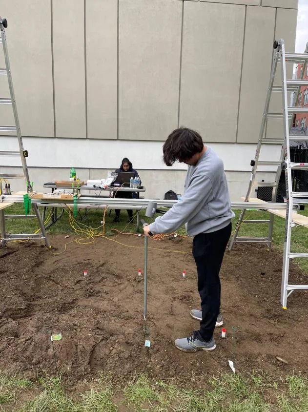
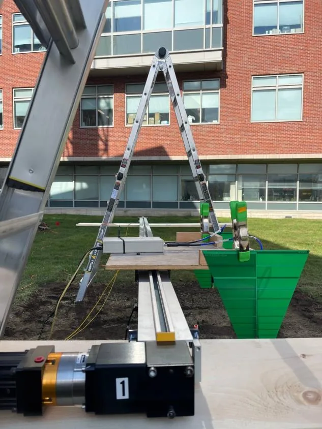
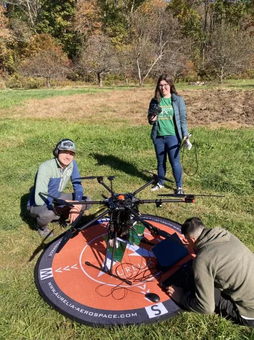
Custom airborne GPR tested in WPI's in-situ lab and at real farmlands across the region, under controlled and live conditions.
Machine learning converts raw GPR signals into classified moisture maps — augmented by synthetic data from gprMax FDTD simulations.
01 — Imaging
We redesign radar systems that integrate with drones and equip them with AI for soil subsurface 3D image creation and root-zone moisture classification — enabling optimized irrigation equipment placement.
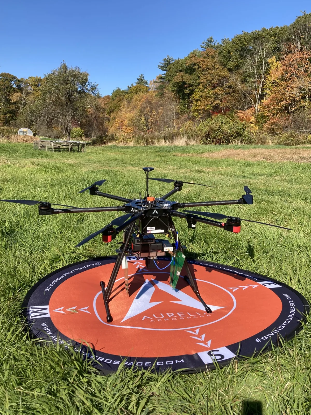
02 — Platform
We developed a Ground Penetrating Radar and mounted it on a drone for aerial farm measurement. Tests run at our in-situ SoilX Lab at WPI and at real farmlands across the region.
03 — Intelligence
The drone-mounted radar converts received signals into 3D moisture and texture maps via machine learning — visualized as cross-sections or 3D models revealing soil layers, moisture pockets, and irrigation zones.
In-situ facility · WPI
30 × 20 × 3
feet — excavated test area
An in-situ laboratory at WPI for controlled soil measurements. We excavated and equipped a 30×20×3 ft area for precise GPR data collection — enabling labeled datasets for supervised machine learning under real soil conditions.
Toward Intelligent GPR: Wavelet Scattering Networks for Soil Water Content Prediction
FDTD Medium Dimension Selection Guidelines for GPR Synthetic Data Generation
Advancing Precision Agriculture: Machine Learning-Enhanced GPR Analysis for Root-Zone Soil Moisture Assessment in Mega Farms